

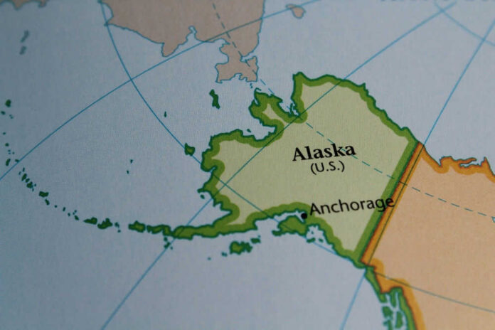
Eight people died when a chartered twin‑engine plane crashed beside a remote Alaska radar site, and the recovery team found no survivors.
Story Snapshot
- Military officials reported a fatal crash near the Cape Newenham Long Range Radar Site with eight aboard.
- The U.S. Army Corps of Engineers confirmed two of its employees were among the dead.
- Federal records identify the flight as a Security Aviation charter, approaching the site when it went down.
- The National Transportation Safety Board set the crash window around late morning on August 20, 2026.
What Happened, Where, and When
Alaskan Command, the Alaskan North American Aerospace Defense Region, and the 11th Air Force said a civilian-contracted aircraft crashed at the Cape Newenham Long Range Radar Site Airport in western Alaska. Responders reached the scene and confirmed there were no survivors among the eight onboard.
The site sits about 450 miles west of Anchorage, far from roads and towns, on a wind-battered bluff above the Bering Sea. The National Transportation Safety Board said the accident occurred on August 20 at about 11:45 a.m. local time.
All eight people aboard a plane chartered by the Army Corps of Engineers were killed in a crash near a remote radar site on the western coast of Alaska.
Read more at: https://t.co/vcg2PPnNDa
— Stars and Stripes (@starsandstripes) August 23, 2026
The U.S. Army Corps of Engineers said two of its employees were passengers and died in the crash, with next of kin notified. That agency often charters flights to reach military and federal sites off the road system.
The board and the Federal Aviation Administration opened investigations. Law enforcement and military units secured the area to aid recovery and preserve evidence. Officials did not release the names of the other six people as of the latest updates.
The Flight Profile and the Airplane
Preliminary federal information, as summarized by industry reports, identified the aircraft as a Cessna 441 Conquest II operated by Security Aviation on an on-demand charter. The flight used the call sign SVX45 and was in the approach phase to the radar site when it crashed.
Eight people were onboard: two pilots and six passengers. Early accounts from multiple national outlets match the head count, phases of flight, and the location near the Cape Newenham airport.
The Cessna 441 is a pressurized, twin‑turboprop workhorse built for speed and range on tough routes. Operators in Alaska favor such aircraft for reaching short gravel strips and isolated facilities.
That performance profile appeals to contractors, but it also demands tight discipline on weather, terrain clearance, and approach procedures.
Aviation in this part of Alaska often involves steep terrain, fast-changing ceilings, and thin navigation aids. Pilots treat each landing like a short, high-stakes chess match against time and visibility.
Remote Terrain, Harsh Weather, and Rescue Limits
Cape Newenham’s airport serves a long-range radar site that supports homeland defense. The strip is short, coastal, and exposed. Weather can slide from marginal to unsafe in minutes.
Military sources and early press reports referenced poor visibility near the time of the crash, but investigators have not issued a final weather reconstruction.
The remoteness slowed outside access. That distance is normal for Alaska and often shapes the first hours of any response and the evidence teams can gather on scene.
Search and recovery in this region depends on coordination between military rescue units, state troopers, and federal agencies. Crews must stage fuel, plan around tides, and work between cloud decks.
That complexity does not change the bottom line: responders reached the wreckage and confirmed that the eight aboard did not survive.
The secure perimeter allows National Transportation Safety Board teams to document impact angles, control settings, and instrument positions needed to recreate the flight path.
Alaska’s Broader Aviation Risk, Without Guessing at Cause
Accident investigators caution against jumping to a cause. The National Transportation Safety Board has said only that the team is gathering facts. That said, the setting fits a larger Alaska pattern.
Over the last decade, Alaska has had higher aviation accident and fatal accident rates than the rest of the country, driven by rugged terrain, weather, and the need to fly to reach basic services. The National Transportation Safety Board has documented that gap in multiple safety studies.
Charter operations like this flight, often called Part 135 in federal rules, carry a large share of the state’s fatal crashes because they serve remote sites on tight timelines. The mix of mission pressure, thin margins, and tough fields raises the stakes on every approach.
The common-sense fix is not a slogan; it is a system. Better weather tools, clearer approach procedures, enhanced training, and strong safety culture all reduce risk.
What Comes Next
Investigators will piece together radio calls, radar traces, maintenance records, and any cockpit audio. They will compare instrument procedures with real-world weather and terrain.
The board will release a preliminary report with basic facts, then a final report with the probable cause. Families and co-workers now face hard news. The aim, always, is to learn fast, fix what can be fixed, and make sure people who fly tomorrow come home.
Sources:
alaskasnewssource.com, alaskapublic.org, poa.usace.army.mil, airwaysmag.com, abcnews.com, reuters.com, nbcnews.com, youtube.com